Data Sets (110)
|
1 of 6
Prev
|
Next
|
Global Pesticide Grids (PEST-CHEMGRIDS), v1.01 (2015, 2020, 2025)Global Agricultural Inputs, v1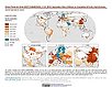
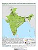
To provide a global gridded data set of commonly-used agricultural pesticides crucial to assess human and ecosystem exposure to potential toxicants for environmental modeling, assessment of agricultural chemical contamination and risk analysis, and other related research at global, regional, national, and local levels. |
Global 1-km Downscaled Population Base Year and Projection Grids Based on the SSPs, v1.01 (
|
|
VIIRS Plus DMSP Change in Lights (VIIRS+DMSP dLIGHT), v1 (1992, 2002, 2013)Satellite-Derived Environmental Indicators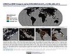
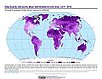
To visualize changes in brightness and extent of global nighttime lights networks over two decades with improved radiometric accuracy and finer spatial resolution. |
Global One-Eighth Degree Population Base Year and Projection Grids Based on the SSPs, v1.01 (
|
|
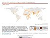
Global Human Modification of Terrestrial Systems, v1 (2016)Land Use and Land Cover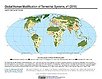
To provide a cumulative measure of human modification of terrestrial lands based on modeling the physical extents of 13 anthropogenic stressors and their estimated impacts using spatially-explicit global data sets. |
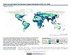
Global Development Potential Indices, v1 (2016)Land Use and Land Cover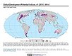
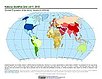
To provide spatially-explicit data that relatively rank global land suitability referred to as Development Potential Indices (DPIs) for 13 sectors related to renewable energy, fossil fuels, mining and agriculture as an aid to conservation priority setting. |
|
Environmental Performance Index, 2020 Release (
|
||
Development Threat Index, v1 (2015)Land Use and Land Cover (LULC)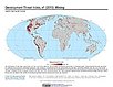
To provide a future development threat map based on combining these resources: agricultural expansion, urban expansion, conventional oil and gas, unconventional oil and gas, coal, mining, biofuels, solar, and wind. |
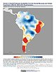
Trends in Global Freshwater Availability from the Gravity Recovery and Climate Experiment (GRACE), v1 (
|
|
Urban Extents from VIIRS and MODIS for the Continental U.S. Using Machine Learning Methods, v1 (2015)Urban Spatial Data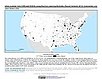
To provide representations of urban areas in the Continental U.S. in the year 2015 to support sustainable urban development planning in accordance with the growth of urban areas. |
UN WPP-Adjusted Population Density, v4.11 (2000, 2005, 2010, 2015, 2020)Gridded Population of the World (GPW), v4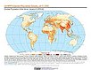
To provide estimates of population density for the years 2000, 2005, 2010, 2015, and 2020, based on counts consistent with national censuses and population registers with respect to relative spatial distribution, but adjusted to match United Nations country totals. |
|
Population Density, v4.11 (2000, 2005, 2010, 2015, 2020)Gridded Population of the World (GPW), v4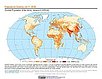
To provide estimates of population density for the years 2000, 2005, 2010, 2015, and 2020, based on counts consistent with national censuses and population registers, as raster data to facilitate data integration. |
Basic Demographic Characteristics, v4.11 (2010)Gridded Population of the World (GPW), v4To provide estimates of population counts by age and sex for the year 2010, consistent with national censuses and population registers, as raster data to facilitate data integration. |
|
Population Count, v4.11 (2000, 2005, 2010, 2015, 2020)Gridded Population of the World (GPW), v4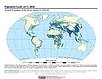
To provide estimates of population count for the years 2000, 2005, 2010, 2015, and 2020, consistent with national censuses and population registers, as raster data to facilitate data integration. |
||
Administrative Unit Center Points with Population Estimates, v4.11 (2000, 2005, 2010, 2015, 2020)Gridded Population of the World (GPW), v4To provide a vector (point) version of the input administrative units used in GPWv4 with population estimates, densities, 2010 basic demographic characteristics, and administrative name, area, and data context for use in data integration. |
||
UN WPP-Adjusted Population Count, v4.11 (2000, 2005, 2010, 2015, 2020)Gridded Population of the World (GPW), v4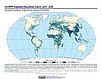
To provide estimates of population count for the years 2000, 2005, 2010, 2015, and 2020, consistent with national censuses and population registers with respect to relative spatial distribution, but adjusted to match United Nations country totals. |
|
1 of 6
Prev
|
Next
|