Data Sets (47)
| 2 of 3 |
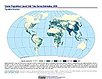
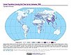
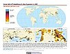
UN WPP-Adjusted Population Count, v4.11 (2000, 2005, 2010, 2015, 2020)Gridded Population of the World (GPW), v4
To provide estimates of population count for the years 2000, 2005, 2010, 2015, and 2020, consistent with national censuses and population registers with respect to relative spatial distribution, but adjusted to match United Nations country totals. |
||
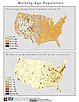
Summary File 3: Metropolitan Statistical Areas, v1 (1990)U.S. Census GridsTo provide gridded demographic data, including characteristics of income, education, and housing, for metropolitan statistical areas at a finer resolution than is available in the 30 arc-second grids used for the United States as a whole. |
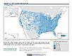
Summary File 3, v1 (1990)U.S. Census GridsTo provide gridded demographic data, including characteristics of income, education, and housing, for the United States for data integration. |
|
Summary File 1: Metropolitan Statistical Areas, v1 (1990)U.S. Census GridsTo provide gridded demographic data, including characteristics of age, race, ethnicity, and housing, for metropolitan statistical areas at a finer resolution than is available in the 30 arc-second grids used for the United States as a whole. |
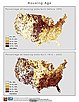
Summary File 1, v1 (1990)U.S. Census GridsTo provide gridded demographic data, including characteristics of age, race, ethnicity, and housing, for the United States. |
|
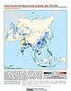
Population Count Grid, v1 (1990, 1995, 2000)Global Rural-Urban Mapping Project (GRUMP), v1To provide a time series of raster population data for ntegration with other data sets. |
Urban Extents Grid, v1 (1995)Global Rural-Urban Mapping Project (GRUMP), v1
To provide a raster representation of urban areas (or urban mask) for use with GRUMP population grids or other data sets. |
|
Land and Geographic Unit Area Grids, v1 (2000)Global Rural-Urban Mapping Project (GRUMP), v1To provide land area data for use with GRUMPv1 population and urban data as well as a quantitative measure of resolution of the input spatial units for GRUMPv1. |
Population Density Grid, v1 (1990, 1995, 2000)Global Rural-Urban Mapping Project (GRUMP), v1
To provide a time series of raster population density data for data integration. |
|
National Identifier Grid, v1 (1995, 2000, 2010)Global Rural-Urban Mapping Project (GRUMP), v1To permit the summation of population values by country/territory and, in combination with other data layers, the summation of population values by irregular areas represented in the other data layers and country/territory. |
||
Summary File 3: Metropolitan Statistical Areas, v1 (2000)U.S. Census Grids
To provide gridded demographic data, including characteristics of income, education, and housing, for metropolitan statistical areas at a finer resolution than is available in the 30 arc-second grids used for the United States as a whole. |
||
Summary File 1: Metropolitan Statistical Areas, v1 (2000)U.S. Census Grids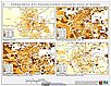
To provide gridded demographic data, including characteristics of age, race, ethnicity, and housing, for metropolitan statistical areas at a finer resolution than is available in the 30 arc-second grids used for the United States as a whole. |
MA Population, v1 (
|
| 2 of 3 |