Data Sets (43)
| 2 of 3 |
U.S. EPA National Priorities List Sites with CIESIN Modifications, v2 (2014)Superfund Site Footprints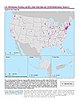
To provide an easily accessible, corrected EPA data set of the geo-referenced locations displayed as points for all the National Priorities List (NPL) Superfund sites in the United States, Puerto Rico, and other territories. |
Global Roads Open Access Data Set (gROADS), v1 (
|
|
Dams, v1.01 (2011)Global Reservoir and Dam (GRanD), v1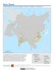
To provide a geographically explicit and reliable database of dams for the scientific community. |
Reservoirs, v1.01 (2011)Global Reservoir and Dam (GRanD), v1
To provide a geographically explicit and reliable database of reservoirs for the scientific community. |
|
ATSDR Hazardous Waste Site Polygon Data, v2 (2010)Superfund Site FootprintsTo provide the ATSDR polygon data set of hazardous waste sites in the United States, Puerto Rico, and other territories which can be used to identify nearby populations and assess their potential risk. |
CODATA Catalog of Roads, v1 (
|
|
Coastlines, v3 (2000)Gridded Population of the World (GPW), v3To provide a set of coastlines consistent with GPWv3 raster data for cartographic purposes. |
Subnational Administrative Boundaries, v3 (1990, 1995, 2000)Gridded Population of the World (GPW), v3
To provide maps of the input administrative units used in GPWv3. |
|
National Identifier Grid, v3 (2000)Gridded Population of the World (GPW), v3To provide a raster representation of nation-states in GPWv3 for use in aggregating population data. |
National Administrative Boundaries, v3 (2000)Gridded Population of the World (GPW), v3To provide a quantitative measure of the input resolution of administrative units used for GPWv3. |
|
Land and Geographic Unit Area Grids, v3 (1990, 1995, 2000, 2005, 2010, 2015)Gridded Population of the World (GPW), v3To provide a quantitative measure of the input resolution of administrative units used for GPWv3. |
Centroids, v3 (1990, 1995, 2000, 2005, 2010, 2015)Gridded Population of the World (GPW), v3To provide a vector (point) version of the input administrative units used in GPWv3 for use in data integration. |
|
China Maps Bibliographic Database, v1 (
|
GuoBiao (GB) Codes for the Administrative Divisions of the Peoples Republic of China, v1 (
|
|
Bibliography of Chinese Administrative Geography, v1 (
|
China County-Level Data from Provincial Economic Yearbooks, Keyed to 1:1M GIS Map, v1 (
|
|
Fundamental GIS Digital Chart of China, 1:1M, v1 (1993)China DimensionsTo provide fundamental GIS maps of China, and neighboring countries and regions. |
China Administrative Regions GIS Data: 1:1M, County Level, v1 (1990)China DimensionsTo provide information of geographical locations, areas, administrative division codes, and names for the administrative regions of China. |
|
China Administrative Regions GIS Data 1:1M, County Level, v1.01 (1990)China DimensionsTo provide information on the geographical locations, areas, administrative division codes, and names of the administrative regions of China. |
Boundary Files, v1 (
|
| 2 of 3 |