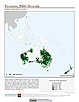
Anthropogenic Biomes
To provide information on anthropogenic transformation of the biosphere circa 1900 for global land use studies and research on human-environment interactions.
|
|
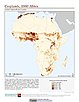
Global Agricultural Inputs, v1
To provide phosphorus in manure production data that can be used in socioeconomic and ecological modeling and to explore anthropogenic activities on ecosystems.
|
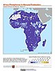
Global Agricultural Inputs, v1
To provide phosphorus fertilizer application data that can be used in socioeconomic and ecological modeling and to explore anthropogenic activities on ecosystems.
|
|
Global Agricultural Inputs, v1
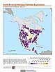
To provide nitrogen fertilizer application data that can be used in socioeconomic and ecological modeling and to explore anthropogenic activities on ecosystems.
|
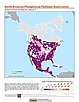
Global Agricultural Inputs, v1

To provide nitrogen in manure production data that can be used in socioeconomic and ecological modeling and to explore anthropogenic activities on ecosystems.
|
|
Global Agricultural Lands
To provide data on the extent of croplands for research on human-environment interactions.
|
Global Agricultural Lands
To provide data on the extent of pasturelands for research on human-environment interactions.
|
|
Anthropogenic Biomes
To provide information on global land use for research on human-environment interactions.
|
Global High Resolution Urban Data from Landsat
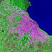
To serve a wide user community by providing composite Landsat images and raw data for urban areas that can be used in interdisciplinary studies of remote sensing and the environment.
|
|
Last of the Wild, v2
To provide an updated map of anthropogenic impacts on the environment in geographic projection which can be used in wildlife conservation planning, natural resource management, and research on human-environment interactions.
|
Last of the Wild, v2
To provide an updated map of anthropogenic impacts on the environment in Interrupted Goode Homolosine Projection which can be used in wildlife conservation planning, natural resource management, and research on human-environment interactions.
|
|
Last of the Wild, v2
To provide an updated map of anthropogenic impacts on the environment in the Interrupted Goode Homolosine Projection which can be used in wildlife conservation planning, natural resource management, and research on human-environment interactions.
|
Last of the Wild, v2
To provide an updated map of anthropogenic impacts on the environment in geographic projection which can be used in wildlife conservation planning, natural resource management, and research on human-environment interactions.
|
|
Millennium Ecosystem Assessment (MA)
To preserve access to the original climate and land cover data used by the Millennium Ecosystem Assessment (MA) and other related research.
|
Millennium Ecosystem Assessment (MA)
To preserve access to the original ecosystems data used by the Millennium Ecosystem Assessment (MA) and other related research.
|
|
Millennium Ecosystem Assessment (MA)
To preserve access to the original rapid land cover change data used by the Millennium Ecosystem Assessment (MA) and other related research.
|
Millennium Ecosystem Assessment (MA)
To preserve access to the original biodiversity data used by the Millennium Ecosystem Assessment (MA) and other related research.
|
|
Millennium Ecosystem Assessment (MA)
To preserve access to the original set of socioeconomic and natural resource scenarios used by the Millennium Ecosystem Assessment (MA) and other related research.
|
Last of the Wild, v1
To provide a map of anthropogenic impacts on the environment in geographic projection which can be used in modeling efforts, wildlife conservation planning, natural resource management, policy-making, biodiversity studies and human-environment interactions.
|
|
Last of the Wild, v1
To provide a map of anthropogenic impacts on the environment in the Interrupted Goode Homosoline Projection which can be used in wildlife conservation planning, natural resource management, and research on human-environment interactions.
|