Data Sets » Format: vectorRemove Facet
3 of 4

MA Climate and Land Cover, v1 (1901 – 2000)

Millennium Ecosystem Assessment (MA)

To preserve access to the original climate and land cover data used by the Millennium Ecosystem Assessment (MA) and other related research.

MA Ecosystems, v1 (2000)

Millennium Ecosystem Assessment (MA)

To preserve access to the original ecosystems data used by the Millennium Ecosystem Assessment (MA) and other related research.

MA Rapid Land Cover Change, v1 (1901 – 2015)

Millennium Ecosystem Assessment (MA)

To preserve access to the original rapid land cover change data used by the Millennium Ecosystem Assessment (MA) and other related research.

Unsatisfied Basic Needs, v1 (1998 – 2001)

Poverty Mapping

To provide high spatial resolution subnational estimates of unsatisfied basic needs for use by a wide community for interdisciplinary studies of poverty, inequality and the environment.

Small Area Estimates of Poverty and Inequality, v1 (1990 – 2002)

Poverty Mapping

To provide high spatial resolution subnational estimates of poverty and inequality for use by a wide user community for interdisciplinary studies of poverty, inequality and the environment.

Global Subnational Prevalence of Child Malnutrition, v1 (1990 – 2002)

Poverty Mapping

To provide a global subnational map of the prevalence of underweight children that can be used by a wide user community in interdisciplinary studies of health, poverty and the environment.

Poverty and Food Security Case Studies, v1 (1998 – 2002)

Poverty Mapping

To provide high spatial resolution subnational estimates of poverty and food security for use by a wide community for interdisciplinary studies of poverty, food security and the environment.

Global Subnational Infant Mortality Rates, v1 (2000)

Poverty Mapping

To provide a global subnational map of infant mortality rate estimates that can be used by a wide user community in interdisciplinary studies of health, poverty and the environment.

MA Biodiversity, v1 (1950 – 2001)

Millennium Ecosystem Assessment (MA)

To preserve access to the original biodiversity data used by the Millennium Ecosystem Assessment (MA) and other related research.

MA Scenarios, v1 (1995 – 2100)

Millennium Ecosystem Assessment (MA)

To preserve access to the original set of socioeconomic and natural resource scenarios used by the Millennium Ecosystem Assessment (MA) and other related research.

Coastlines, v3 (2000)

Gridded Population of the World (GPW), v3

To provide a set of coastlines consistent with GPWv3 raster data for cartographic purposes.

National Administrative Boundaries, v3 (2000)

Gridded Population of the World (GPW), v3

To provide a quantitative measure of the input resolution of administrative units used for GPWv3.

Centroids, v3 (1990, 1995, 2000, 2005, 2010, 2015)

Gridded Population of the World (GPW), v3

To provide a vector (point) version of the input administrative units used in GPWv3 for use in data integration.

Top One Percent Wild Areas (IGHP), v1 (1992 – 1995)

Last of the Wild, v1

To provide a map of the wildest areas in Interrupted Goode Homolosine Projection which can be used in wildlife conservation planning, natural resource management, and research on human-environment interactions.

Last of the Wild (IGHP), v1 (1992 – 1995)

Last of the Wild, v1

To provide a map of wild areas in the Interrupted Goode Homolosine Projection which can be used in wildlife conservation planning, natural resource management, and research on human-environment interactions.

Top One Percent Wild Areas (Geographic), v1 (1992 – 1995)

Last of the Wild, v1

To provide a map of the wildest areas in geographic projection which can be used in wildlife conservation planning, natural resource management, and research on human-environment interactions.

Last of the Wild (Geographic), v1 (1992 – 1995)

Last of the Wild, v1

To provide a map of wild areas in geographic projection which can be used in wildlife conservation planning, natural resource management, and research on human-environment interactions.

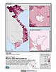
GIS of Mexican States, Municipalities and Islands, v1 (1990)

Georeferenced Population of Mexico

To provide attribute and boundary data for Mexico for conducting assessments of human interactions with the environment.

Central American Vegetation/Land Cover Classification and Conservation Status, v1 (1992 – 1993)

Land Use and Land Cover (LULC)

To identify remaining natural vegetation types in Central America.

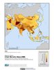
China County-Level Data on Population (Census) and Agriculture, Keyed to 1:1M GIS Map, v1 (1985 – 1990)

China Dimensions

To provide information on China's population and agricultural economy from the 1990 census, and geocoded 1990 China county boundary GIS data at 1:1M.

Data Sets » Format: vectorRemove Facet
3 of 4