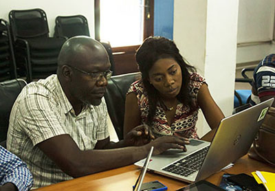
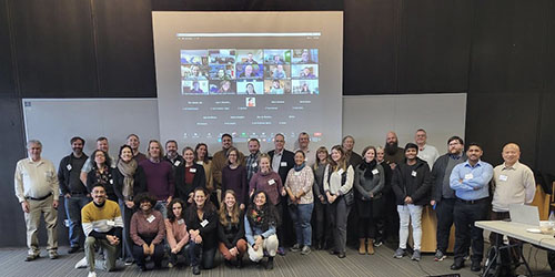
SEDAC Home Register Here Contact Us Site Map
home --> News SEDAC Home You are Here

Implementing Data Sharing Addressed at Italy Workshop

March 12, 2010

Linking Earth observations and other spatial data from many different systems is a goal of the Group on Earth Observations (GEO), an intergovernmental initiative aimed at developing the Global Earth Observing System of Systems (GEOSS). CIESIN associate director for Information Technology, Sri Vinay, is representing CIESIN at an international workshop in Frascati, Italy on March 10-12, helping to kick off the third phase of the GEOSS Architecture Implementation Pilot (AIP-3). CIESIN plans to contribute to AIP-3 by enhancing a new Population Estimation Service. The service, which was developed as part of the NASA Socioeconomic Data and Applications Center (SEDAC), supports spatial queries about population distribution using open interoperability standards. CIESIN is also working to develop user interfaces that recognize open access licenses such as those developed by Creative Commons. Vinay is co-leading a session on data sharing approaches at the workshop and is helping to develop specific scenarios of interoperable data services in several different application areas, which will be demonstrated at the next GEO Ministerial meeting in Beijing in November 2010.

See: Group on Earth Observations
       Architecture Implementation Pilot


Director's Annual Message: Focus on Environmental Sustainability and Disasters

March 8, 2010

Map of potential erosion risk in Port-a-Piment area of Haiti

In just a bit more than five years, the world has experienced an unprecedented string of “megadisasters.” These events were the result not only of the awesome power of earthquakes and cyclones but were also due to the high exposure and extreme vulnerability of populations around the world to a range of hazards. At the end of 2004, the South Asian tsunami shocked the world with its sudden devastation of many densely settled and poorly protected coastal areas. In 2005 and 2008, we witnessed the suffering of hundreds of thousands affected by major earthquakes in Pakistan and China, compounded by poorly constructed schools, dams, and other structures. Hurricane Katrina in 2005 gave us an object lesson about the potential for disaster even in a highly developed country, if governments and citizens fail to prepare for hazards and fail to respond effectively to them. Then Cyclone Nargis in 2008 provided an even more devastating example of the vulnerability of disenfranchised populations worsened by a rogue government. And now we have begun the year 2010 with damaging earthquakes in both Haiti and Chile—the first inflicting much more death and destruction than it should have and leaving a massive and continuing humanitarian crisis in its wake.

These disasters underscore the important roles population location and physical and social vulnerability play in amplifying the risks of natural hazards around the world. We know that population has been growing much faster in coastal areas than elsewhere, often accompanied by accelerated stress on coastal ecosystems and marine resources. Rapid urbanization is occurring in many areas prone to earthquakes, landslides, and/or floods with little or no attention to building codes, protective works, land degradation, or land use restrictions. Poverty continues to force millions to live in substandard housing in environmentally marginal areas with few resources to draw upon when drought, floods, and other hazards strike. Full story


Population Estimation Service and New Mapping Tools Added to GPW Web Site

February 12, 2010

The Web site for CIESIN’s flagship data product—Gridded Population of the World (GPW), now in its third version—has been enhanced with three new services and tools: the Population Estimation Service, a Web-based service for estimating population totals and related statistics within a user-defined region; and two mapping tools.

Because the Population Estimate Service is accessible through three standard protocols (the Open Geospatial Consortium (OGC) Web processing service (WPS) standard, a representational state transfer (REST) interface, and a simple object access protocol (SOAP) interface), it can accommodate a wide variety of map clients and tools and users can quickly obtain population estimates for specific areas without having to download and analyze large amounts of spatial data. Users submit polygons that define an area, then the service returns measures of population, land area, quality measures, and basic parametric statistics. These estimates are based on the gridded population data for 2005 from the GPW v3 data set developed by the NASA Socioeconomic Data and Applications Center (SEDAC) operated by CIESIN.

One of the new mapping tools also released, based on the technology used by Google Maps, demonstrates the Population Estimation Service. It lets users select an area of interest by drawing a polygon on the map and submit the request to the service, and it displays the results. The other tool is a basic mapper that provides previews of the GPW v3 data sets with an overlay of national boundaries, and lets users pan and zoom to an area of interest before downloading the data sets. For more complex visualization and overlay of other data sets, the stand-alone SEDAC Map Client is recommended.

See: Population Estimation Service


New Interactive Mapper Previews Human Influence Data

February 5, 2010

An interactive mapper has been released as part of the Last of the Wild Web site. This new mapper provides previews of the Last of the Wild, Version Two data sets. Using the mapper, users are now able to visualize the human influence index and the human footprint data sets, overlay national boundaries, or pan and zoom to an area of interest to gain a preliminary understanding about the data sets before downloading them. The mapper was developed using the open source Open Layers client technology with Geoserver backend.

For more advanced visualization and overlay with other related data sets, users may turn to the stand-alone SEDAC Map Client, which is offered via CIESIN’s World Data Center for Human Interactions in the Environment Web site. The Last of The Wild, Version Two data sets depict the extent of human influence on terrestrial ecosystems, using data sets compiled on or around the year 2000.

See: Last of the Wild Web site


CIESIN Home Page

Need help or information? Contact SEDAC User Services
About SEDAC  Acknowledgments

NASA Home Page SEDAC logo

Copyright © 1997-2010.
The Trustees of Columbia University in the City of New York.

Privacy Policy and Important Notices