Socioeconomic Data and Applications Center (
sedac
)
A Data Center in NASA's Earth Observing System Data and Information System (
EOSDIS
) — Hosted by
CIESIN
at
Columbia University
Search SEDAC
Data
Data Sets
Maps
Web Pages
search
Data
· Data Sets
· Data Collections
· Featured Data Uses
· Data Citations
· Citations Database
· Data Submission
Maps
· Map Gallery
· Map Viewer
· Map Services
· Mapping Tools
Themes
· Agriculture
· Climate
· Conservation
· Governance
· Hazards
· Health
· Infrastructure
· Land Use
· Marine and Coastal
· Population
· Poverty
· Remote Sensing
· Sustainability
· Urban
· Water
Resources
· Guides
· Multimedia
· Networks
· News
· Publications
· Related Sites
· Remote Sensing
· Tools
Social Media
· Twitter
· FaceBook
· YouTube
· Flickr
· Blog Posts
· Communities
About
· About SEDAC
· User Working Group
· Privacy
· User Registration
Help
Map Gallery
(58)
Follow Us:
Twitter
Follow Us on Facebook
YouTube
Flickr
| Share:
Twitter
Facebook
Search
All Fields:
search
Maps
»
Theme: Remote Sensing
Remove Facet
»
Region: Global
Remove Facet
2 of 2
Prev
|
Next
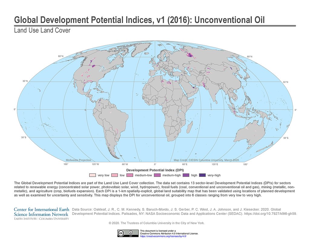
Development Potential Indices (2016): Unconventional Oil
Development Potential Indices (2016): Wind
HBASE Extent, 2010
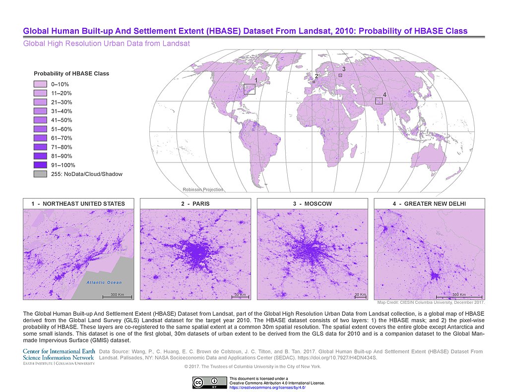
Probability of HBASE Class, 2010
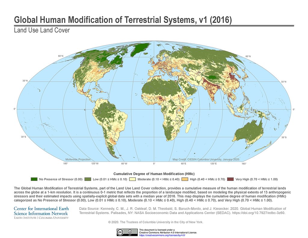
Human Modification of Terrestrial Systems (2016)
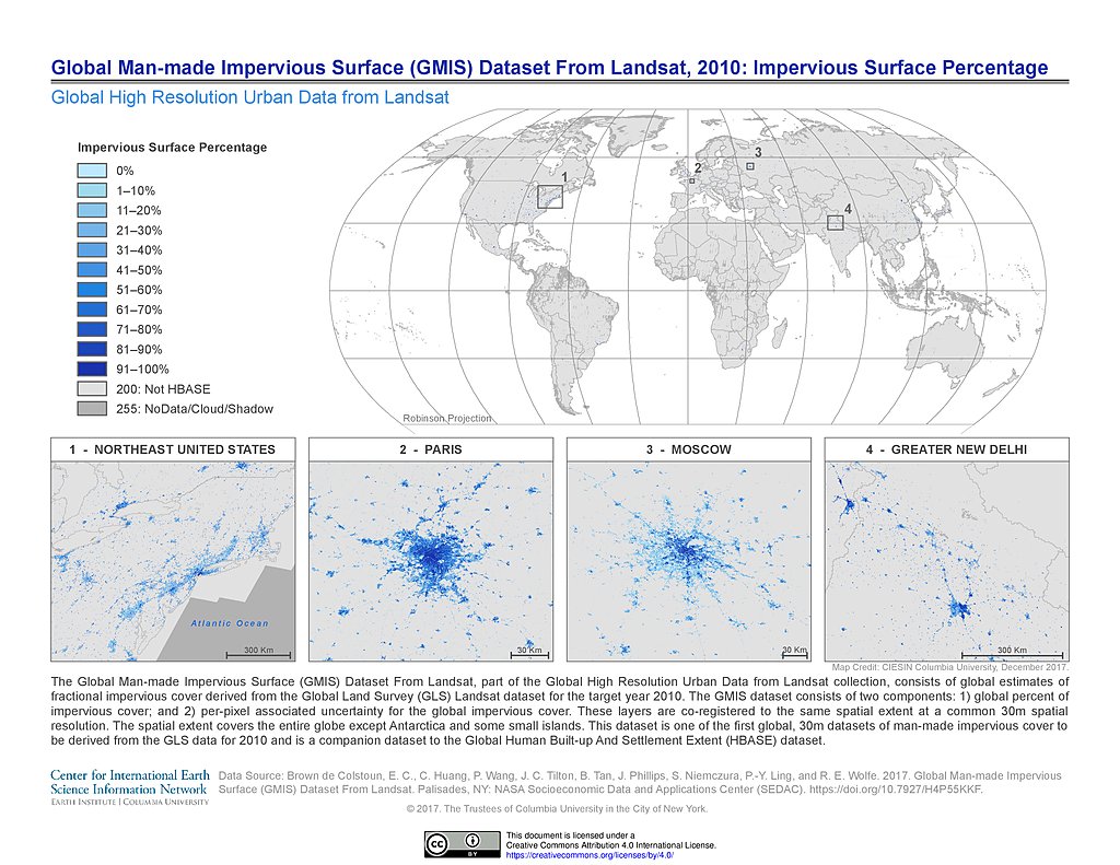
GMIS Impervious Surface Percentage, 2010
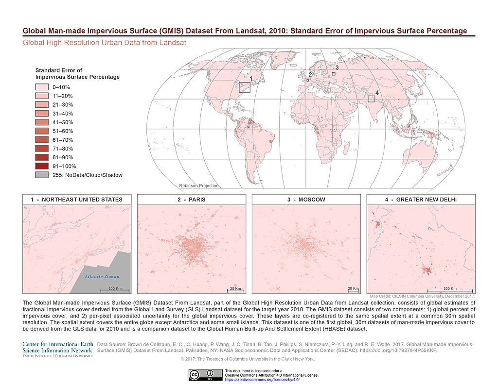
GMIS Standard Error Impervious Surface Percentage, 2010
UHI Average Summer Daytime Maximum Surface Temperature (2013)
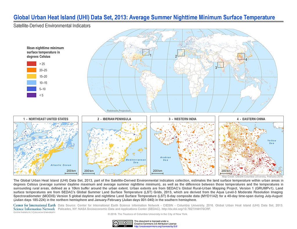
UHI Average Summer Nighttime Minimum Surface Temperature (2013)
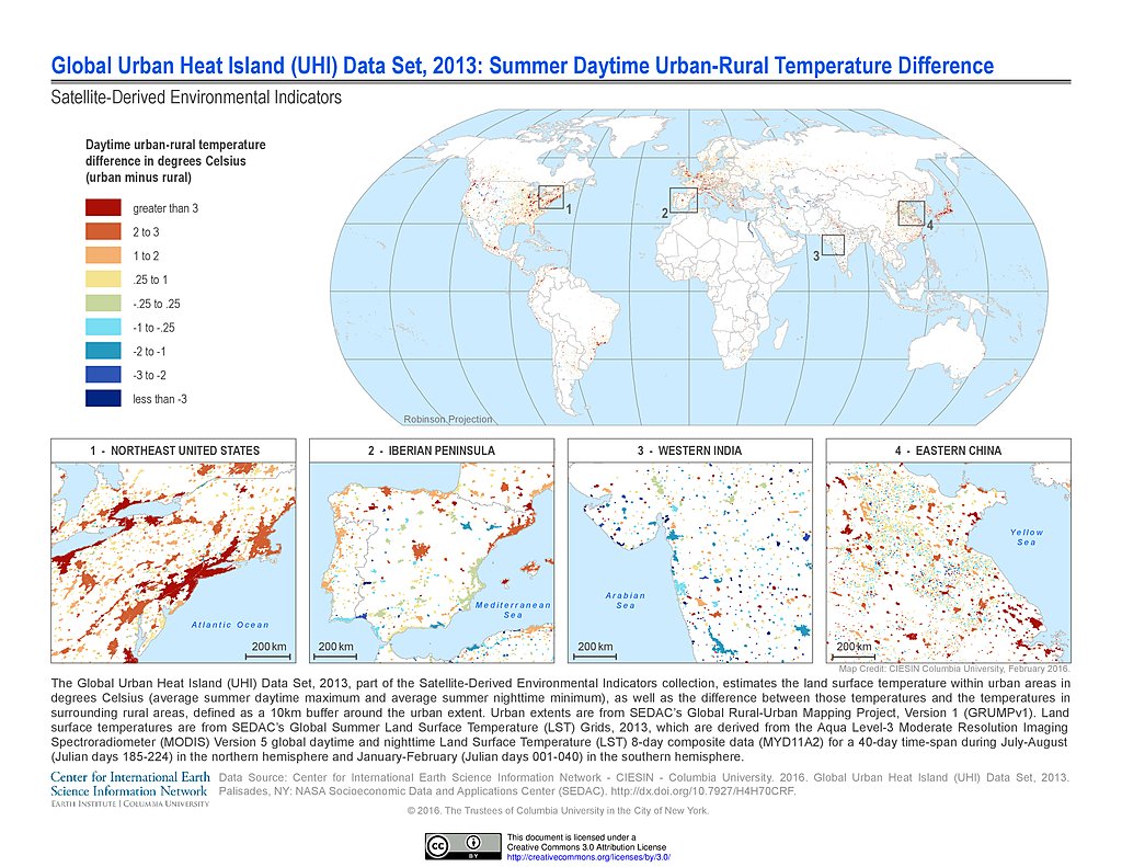
UHI Summer Daytime Urban-Rural Temperature Difference (2013)
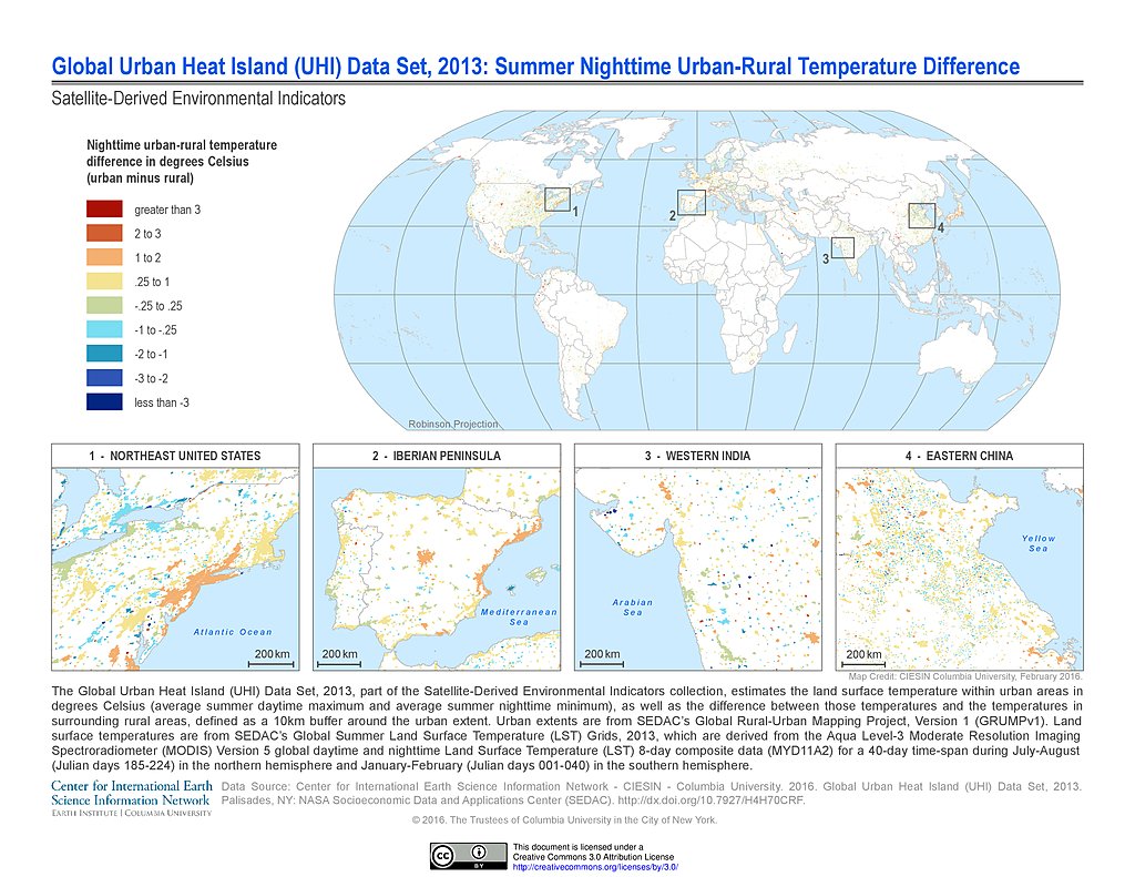
UHI Summer Nighttime Urban-Rural Temperature Difference (2013)
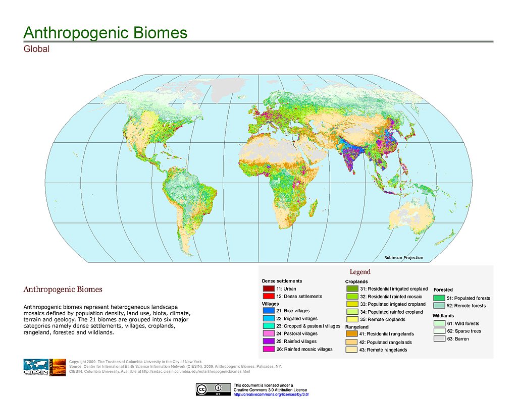
Anthropogenic Biomes, v1
Last of the Wild, v2
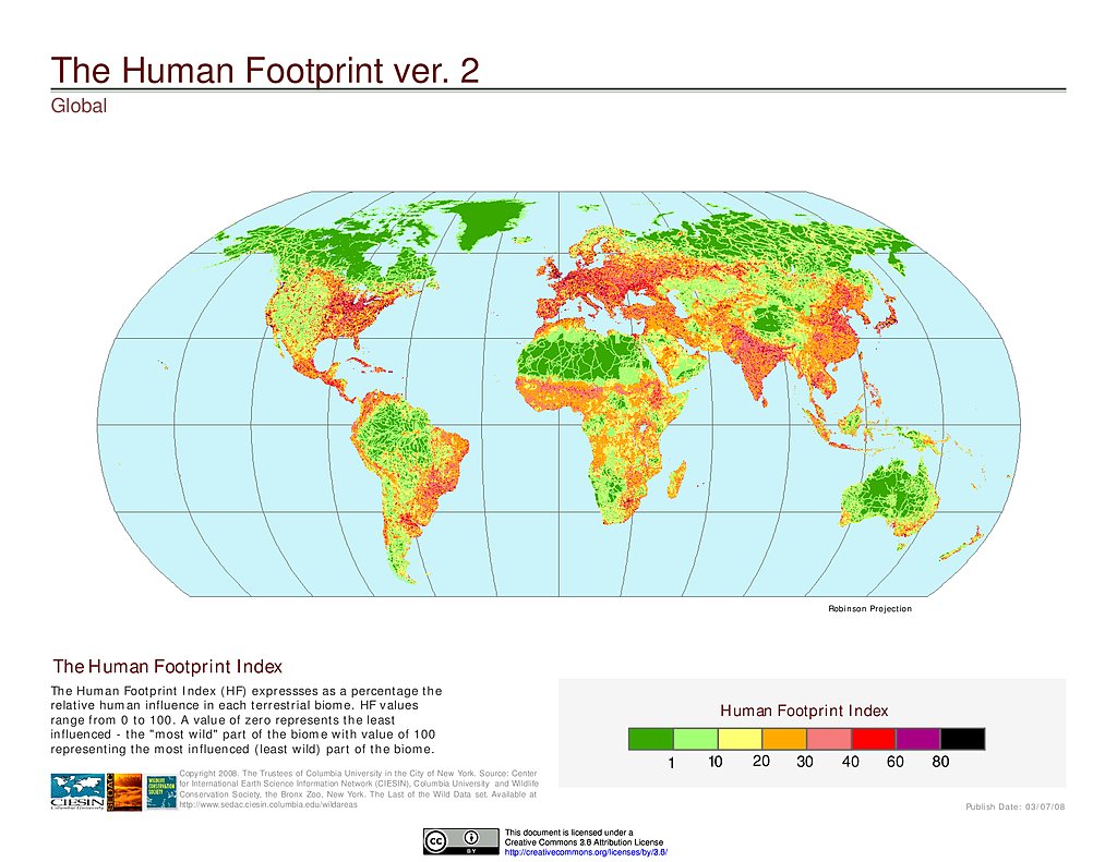
Human Footprint Index, v2
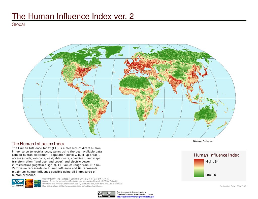
Human Influence Index, v2
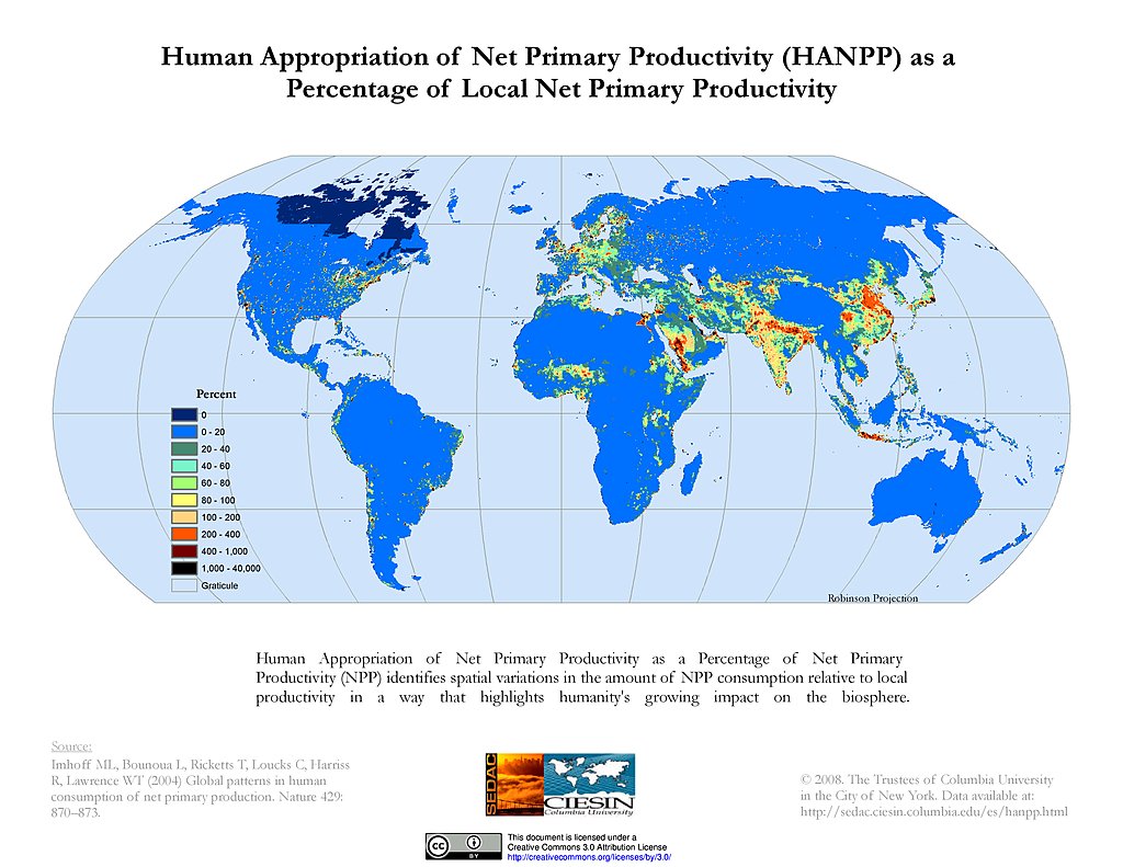
HANPP as % of Local Net Primary Productivity
Pastures (2000)
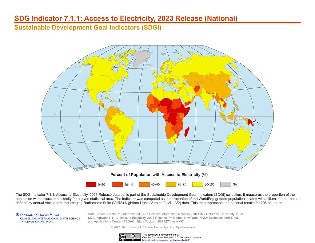
SDGI (2023): 7.1.1 Access to Electricity, National
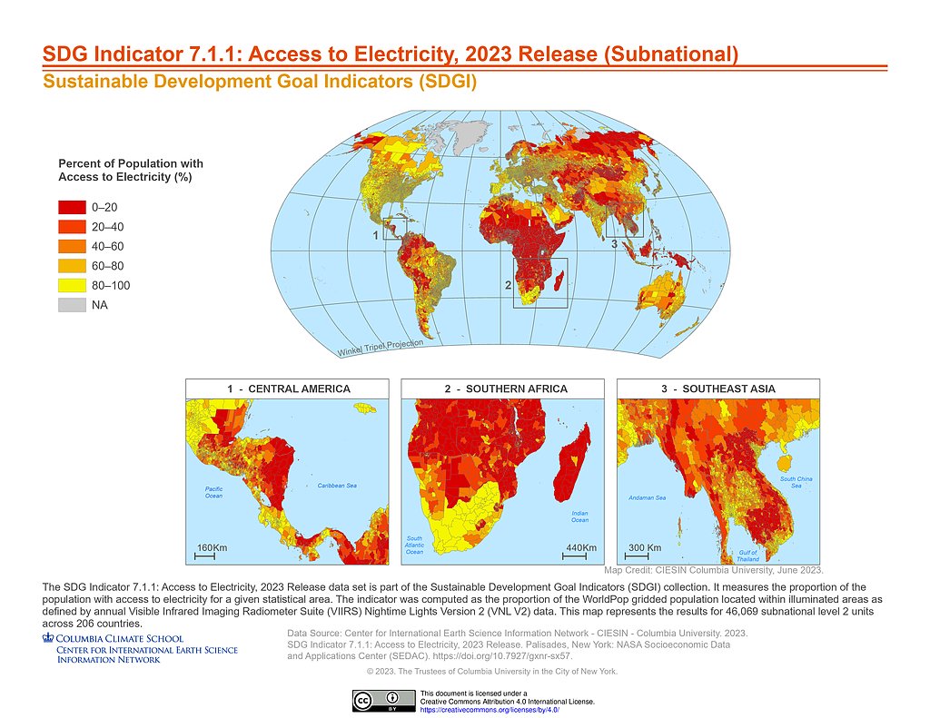
SDGI (2023): 7.1.1 Access to Electricity, Subnational
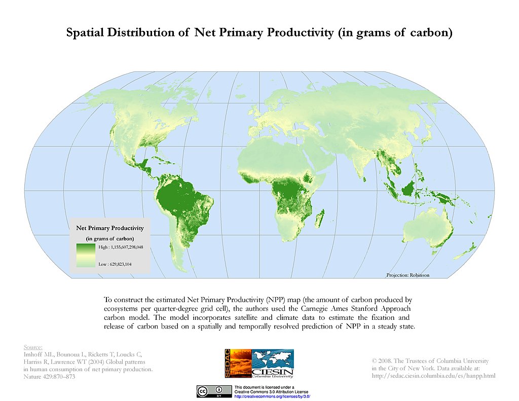
Spatial Distribution of Net Primary Productivity
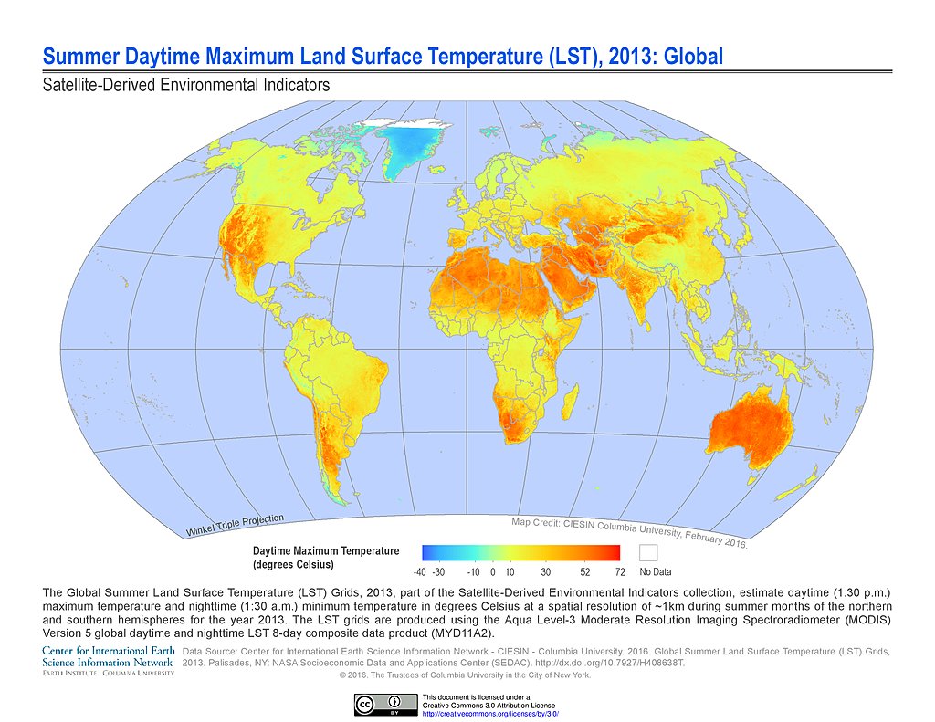
Summer Daytime Maximum LST (2013)
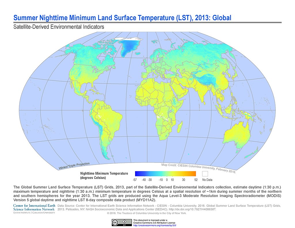
Summer Nighttime Minimum LST (2013)
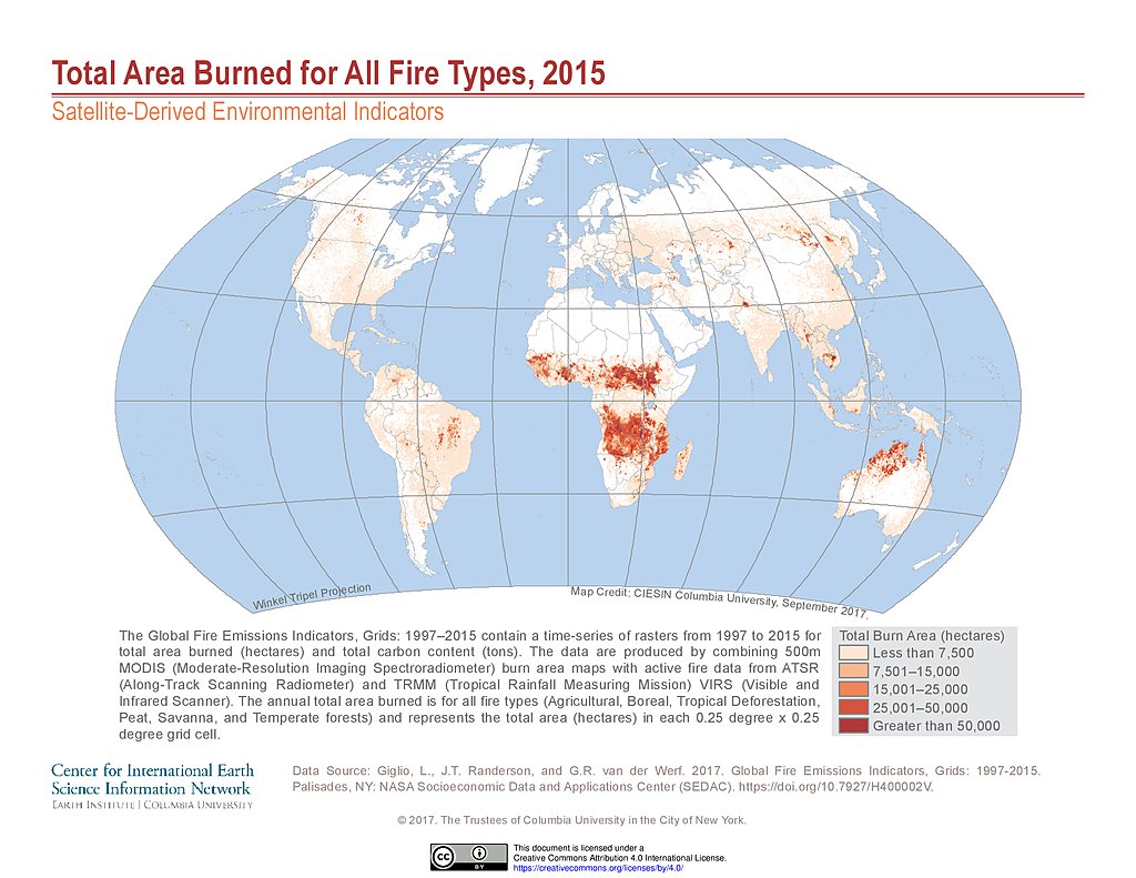
Total Area Burned All Fire Types (2015)
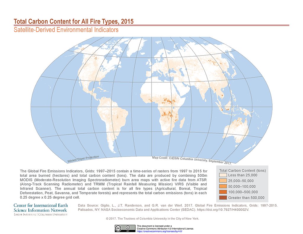
Total Carbon Content All Fire Types (2015)
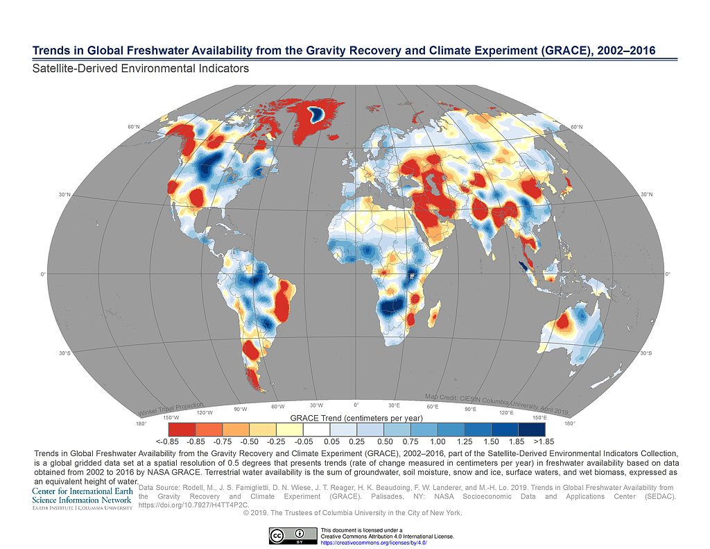
GRACE Freshwater Availability Trends (2002-2016)
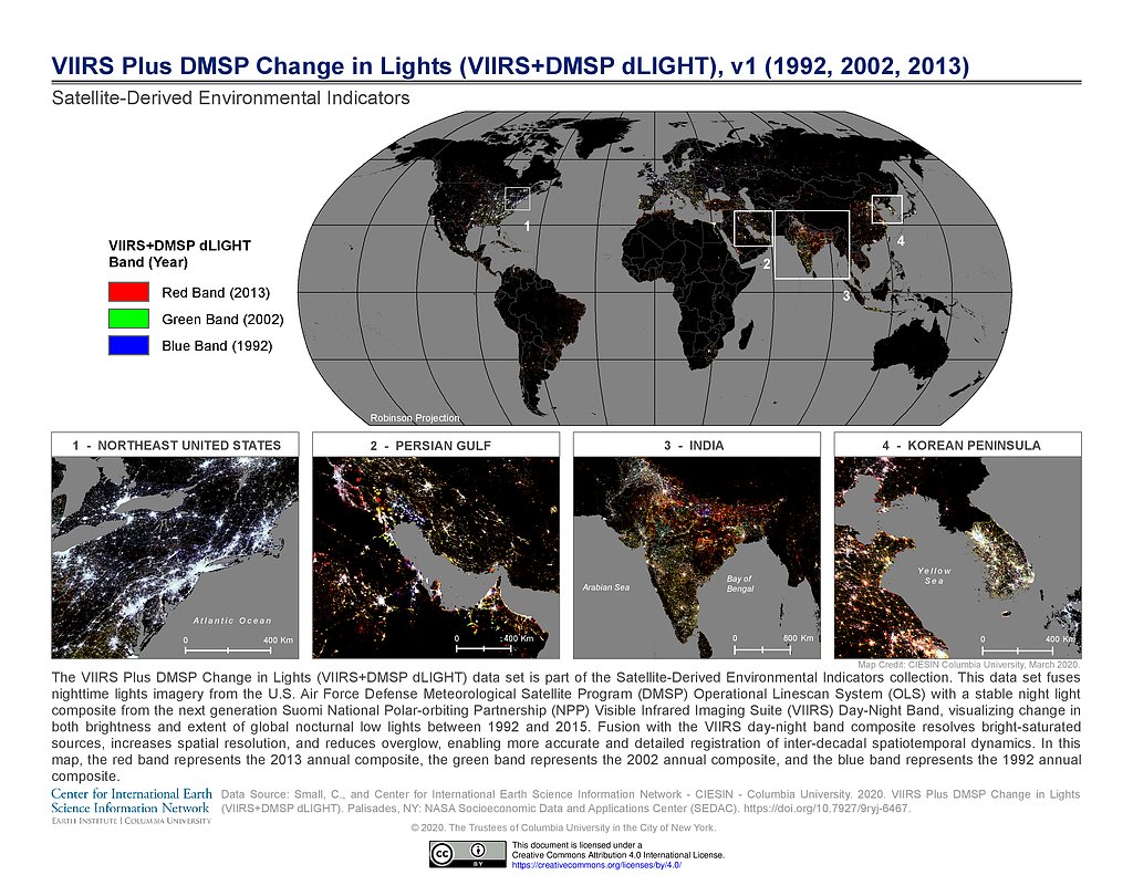
VIIRS Plus DMSP Change in Lights (1992, 2002, 2013)
Maps
»
Theme: Remote Sensing
Remove Facet
»
Region: Global
Remove Facet
2 of 2
Prev
|
Next