Socioeconomic Data and Applications Center (
sedac
)
A Data Center in NASA's Earth Observing System Data and Information System (
EOSDIS
) — Hosted by
CIESIN
at
Columbia University
Search SEDAC
Data
Data Sets
Maps
Web Pages
search
Data
· Data Sets
· Data Collections
· Featured Data Uses
· Data Citations
· Citations Database
· Data Submission
Maps
· Map Gallery
· Map Viewer
· Map Services
· Mapping Tools
Themes
· Agriculture
· Climate
· Conservation
· Governance
· Hazards
· Health
· Infrastructure
· Land Use
· Marine and Coastal
· Population
· Poverty
· Remote Sensing
· Sustainability
· Urban
· Water
Resources
· Guides
· Multimedia
· Networks
· News
· Publications
· Related Sites
· Remote Sensing
· Tools
Social Media
· Twitter
· FaceBook
· YouTube
· Flickr
· Blog Posts
· Communities
About
· About SEDAC
· User Working Group
· Privacy
· User Registration
Help
Gridded Population of the World
(
GPW
)
, v4
Follow Us:
Twitter
Follow Us on Facebook
YouTube
Flickr
| Share:
Twitter
Facebook
Collection Overview
Methods
Data Sets
(9)
Map Gallery
(97)
Search
All Fields:
search
Theme
Land Use
(5)
Population
(30)
Water
(5)
Region
Asia
(1)
Europe
(1)
Global
(33)
Location
Select a Location...
japan
(1)
go
Map Services
(104)
Citations
FAQs
Documentation
What's New in GPWv4
What's New in Revision 10
What's New in Revision 11
What is UN WPP-adjusted population data?
Multimedia
SEDAC Hazards Mapper
Population Estimation Service
Acknowledgments
COVID-19 Viewer
2 of 2
Prev
|
Next
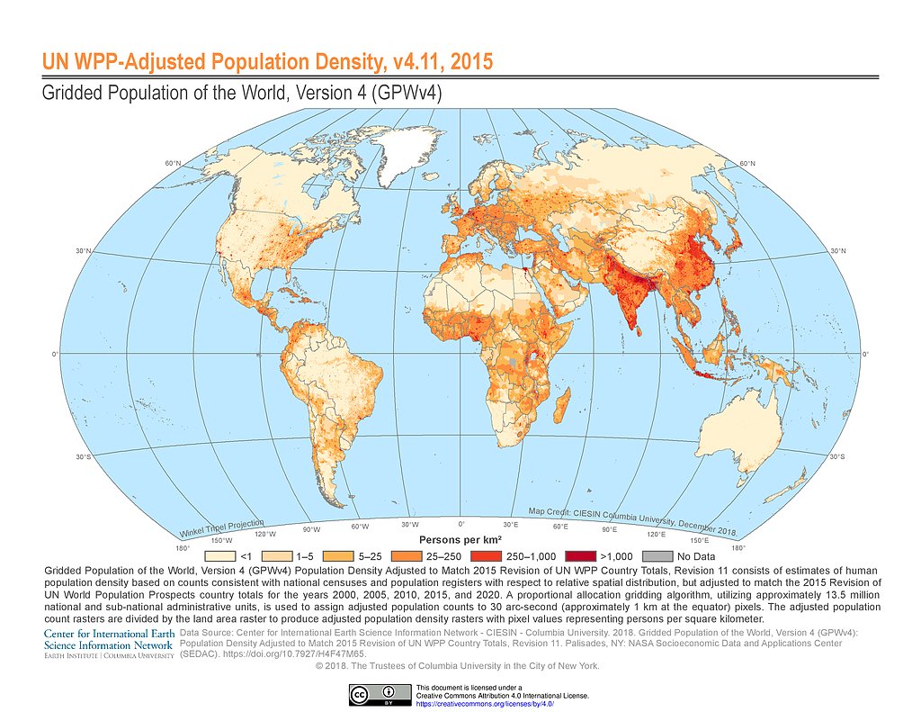
GPWv4 Rev11: UN WPP-Adjusted Population Density (2015)
GPWv4 Rev11: UN WPP-Adjusted Population Density (2020)
GPWv4 Rev11: Water Area (2010)