Data Sets (53)
|
3 of 3
Prev
|
Next
|
Settlement Points, v1 (1990, 1995, 2000)Global Rural-Urban Mapping Project (GRUMP), v1
To provide populated place (point) data with consistent population estimates. |
ATSDR Hazardous Waste Site Polygon Data, v2 (2010)Superfund Site FootprintsTo provide the ATSDR polygon data set of hazardous waste sites in the United States, Puerto Rico, and other territories which can be used to identify nearby populations and assess their potential risk. |
|
Population, Landscape, And Climate Estimates (PLACE), v2 (1990, 2000)National Aggregates of Geospatial Data Collection (NAGDC)
To provide tabular data on environmental conditions (elevations, climate, coastal) in which people reside. |
Urban-Rural Population Estimates, v1 (1990, 1995, 2000)Low Elevation Coastal Zone (LECZ)
To provide estimates of urban and rural populations and land areas in the low elevation coastal zone. |
|
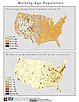
Summary File 3: Metropolitan Statistical Areas, v1 (2000)U.S. Census Grids
To provide gridded demographic data, including characteristics of income, education, and housing, for metropolitan statistical areas at a finer resolution than is available in the 30 arc-second grids used for the United States as a whole. |
||
Summary File 1: Metropolitan Statistical Areas, v1 (2000)U.S. Census Grids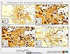
To provide gridded demographic data, including characteristics of age, race, ethnicity, and housing, for metropolitan statistical areas at a finer resolution than is available in the 30 arc-second grids used for the United States as a whole. |
||
Population Count Grid, v3 (1990, 1995, 2000)Gridded Population of the World (GPW), v3To provide a time series of raster data on population to facilitate data integration. |
Population Density Grid Future Estimates, v3 (2005, 2010, 2015)Gridded Population of the World (GPW), v3To provide a time series of raster data on population projected to the year 2015 to facilitate data integration. |
|
Population Count Grid Future Estimates, v3 (2005, 2010, 2015)Gridded Population of the World (GPW), v3To provide a time series of raster data on population projected to the year 2015 to facilitate data integration. |
Population Density Grid, v3 (1990, 1995, 2000)Gridded Population of the World (GPW), v3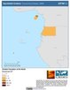
To provide a time series of raster data on population density to facilitate data integration. |
|
Global 15 x 15 Minute Grids of the Downscaled Population Based on the SRES B2 Scenario, v1 (1990, 2025)Socioeconomic Downscaled Projections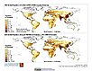
To provide a gridded data on country-level population and downscaled projections based on the SRES B2 marker scenario. |
|
3 of 3
Prev
|
Next
|