Data Sets » Format: tabularRemove Facet » Theme: HealthRemove Facet
2 of 2
Prev | Next

Global Urban Heat Island (UHI) Data Set, v1 (2013)

Satellite-Derived Environmental Indicators

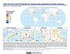
To provide a global data set of average summer daytime maximum/nighttime minimum land surface temperatures (LSTs) for urban extents, as well as the LST difference between the urban area and the buffer.

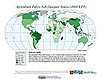
Environmental Performance Index, 2016 Release (1950 – 2016)

Environmental Performance Index (EPI)

To provide quantitative metrics for evaluating a country's environmental performance in different policy categories relative to clearly defined targets.

Environmental Performance Index, 2014 Release (2002 – 2014)

Environmental Performance Index (EPI)

To provide quantitative metrics for evaluating a country's environmental performance in different policy categories relative to clearly defined targets.

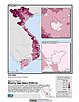
U.S. EPA National Priorities List Sites with CIESIN Modifications, v2 (2014)

Superfund Site Footprints

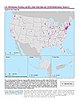
To provide an easily accessible, corrected EPA data set of the geo-referenced locations displayed as points for all the National Priorities List (NPL) Superfund sites in the United States, Puerto Rico, and other territories.

Environmental Performance Index and Pilot Trend Environmental Performance Index, 2012 Release (2000 – 2010)

Environmental Performance Index (EPI)

To provide quantitative metrics for evaluating a country's environmental performance in different policy categories relative to clearly defined targets.

Environmental Performance Index, 2010 Release (1994 – 2009)

Environmental Performance Index (EPI)

To provide quantitative metrics for evaluating a country's environmental performance in different policy categories relative to clearly defined targets.

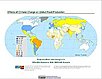
Change in Chlorophyll-a Concentration, v1 (1998 – 2007)

Indicators of Coastal Water Quality

To provide tabular data on the trends of chlorophyll-a concentration on a pixel by pixel basis for identifying areas with improving, declining, and stable coastal water quality that can provide guidance for decision making in the context of coastal management.

Effects of Climate Change on Global Food Production from SRES Emissions and Socioeconomic Scenarios, v1 (1970 – 2080)

Climate Effects on Food Supply

To provide an assessment of potential climate change impacts on world crop production.

Environmental Performance Index, 2008 Release (1994 – 2007)

Environmental Performance Index (EPI)

To provide quantitative metrics for evaluating a country's environmental performance in different policy categories relative to clearly defined targets.

Complete Collection, v1.01 (1973 – 2005)

Compendium of Environmental Sustainability Indicators

To make the acquisition, comparison and analysis of sustainability indicators easier by compiling them in a single database, incorporating multiple country codes, and condensing the indicator descriptions into short methodological summaries in an accompanying data dictionary.

Unsatisfied Basic Needs, v1 (1998 – 2001)

Poverty Mapping

To provide high spatial resolution subnational estimates of unsatisfied basic needs for use by a wide community for interdisciplinary studies of poverty, inequality and the environment.

Small Area Estimates of Poverty and Inequality, v1 (1990 – 2002)

Poverty Mapping

To provide high spatial resolution subnational estimates of poverty and inequality for use by a wide user community for interdisciplinary studies of poverty, inequality and the environment.

Global Subnational Prevalence of Child Malnutrition, v1 (1990 – 2002)

Poverty Mapping

To provide a global subnational map of the prevalence of underweight children that can be used by a wide user community in interdisciplinary studies of health, poverty and the environment.

Poverty and Food Security Case Studies, v1 (1998 – 2002)

Poverty Mapping

To provide high spatial resolution subnational estimates of poverty and food security for use by a wide community for interdisciplinary studies of poverty, food security and the environment.

Global Subnational Infant Mortality Rates, v1 (2000)

Poverty Mapping

To provide a global subnational map of infant mortality rate estimates that can be used by a wide user community in interdisciplinary studies of health, poverty and the environment.

Environmental Sustainability Index, 2005 Release (1980 – 2000)

Environmental Sustainability Index (ESI)

To create a comparative index of national-level environmental sustainability and to provide a mechanism for making environmental management more quantitative, empirically grounded and systematic.

Environmental Sustainability Index, 2002 Release (1980 – 2000)

Environmental Sustainability Index (ESI)

To provide a comparative index of national-level environmental sustainability covering a number of sustainability dimensions.

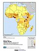
Chinese County-Level Data on Hospitals and Epidemiology Stations, v1 (1950 – 1985)

China Dimensions

To provide descriptive information on health care institutions in China between 1950 and 1985.

Data Sets » Format: tabularRemove Facet » Theme: HealthRemove Facet
2 of 2
Prev | Next