Data Sets (157)
| 5 of 8 |
Urban Extents Grid, v1 (1995)Global Rural-Urban Mapping Project (GRUMP), v1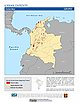
To provide a raster representation of urban areas (or urban mask) for use with GRUMP population grids or other data sets. |
Land and Geographic Unit Area Grids, v1 (2000)Global Rural-Urban Mapping Project (GRUMP), v1To provide land area data for use with GRUMPv1 population and urban data as well as a quantitative measure of resolution of the input spatial units for GRUMPv1. |
|
Population Density Grid, v1 (1990, 1995, 2000)Global Rural-Urban Mapping Project (GRUMP), v1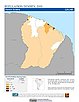
To provide a time series of raster population density data for data integration. |
Settlement Points, v1 (1990, 1995, 2000)Global Rural-Urban Mapping Project (GRUMP), v1
To provide populated place (point) data with consistent population estimates. |
|
Croplands, v1 (2000)Global Agricultural Lands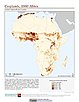
To provide data on the extent of croplands for research on human-environment interactions. |
Pastures, v1 (2000)Global Agricultural Lands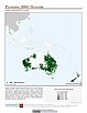
To provide data on the extent of pasturelands for research on human-environment interactions. |
|
ATSDR Hazardous Waste Site Polygon Data, v2 (2010)Superfund Site FootprintsTo provide the ATSDR polygon data set of hazardous waste sites in the United States, Puerto Rico, and other territories which can be used to identify nearby populations and assess their potential risk. |
Environmental Performance Index, 2010 Release (
|
|
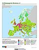
Change in Chlorophyll-a Concentration, v1 (
|
||
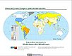
Fourth Assessment Report (AR4) Observed Climate Change Impacts, v1 (
|
||
Environmental Performance Index, 2008 Release (
|
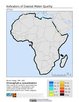
Population, Landscape, And Climate Estimates (PLACE), v2 (1990, 2000)National Aggregates of Geospatial Data Collection (NAGDC)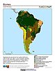
To provide tabular data on environmental conditions (elevations, climate, coastal) in which people reside. |
|
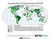
Urban-Rural Population Estimates, v1 (1990, 1995, 2000)Low Elevation Coastal Zone (LECZ)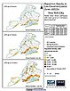
To provide estimates of urban and rural populations and land areas in the low elevation coastal zone. |
||
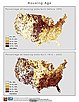
Summary File 3: Metropolitan Statistical Areas, v1 (2000)U.S. Census Grids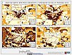
To provide gridded demographic data, including characteristics of income, education, and housing, for metropolitan statistical areas at a finer resolution than is available in the 30 arc-second grids used for the United States as a whole. |
||
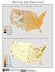
Summary File 1: Metropolitan Statistical Areas, v1 (2000)U.S. Census Grids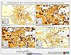
To provide gridded demographic data, including characteristics of age, race, ethnicity, and housing, for metropolitan statistical areas at a finer resolution than is available in the 30 arc-second grids used for the United States as a whole. |
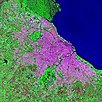
Urban Landsat: Cities from Space, v1 (
|
| 5 of 8 |