Data Sets (295)
|
1 of 15
Prev
|
Next
|
Daily 8-Hour Maximum and Annual O3 Concentrations for the Contiguous United States, 1-km Grids, v1.10 (
|
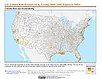
Daily and Annual PM2.5 Concentrations for the Contiguous United States, 1-km Grids, v1.10 (
|
|
Daily and Annual NO2 Concentrations for the Contiguous United States, 1-km Grids, v1.10 (
|
U.S. Climate Risk Projections by County, v1 (
|
|
Annual Mean PM2.5 Components (EC, NH4, NO3, OC, SO4) 50m Urban and 1km Non-Urban Area Grids for Contiguous U.S., v1 (
|
Annual Mean PM2.5 Components Trace Elements (TEs) 50m Urban and 1km Non-Urban Area Grids for Contiguous U.S., v1 (
|
|
Groundswell Africa Spatial Population and Migration Projections at One-Eighth Degree According to SSPs and RCPs, v1 (
|
Annual Global High-Resolution Extreme Heat Estimates (GEHE), v1 (
|
|
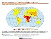
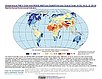
SDG Indicator 7.1.1: Access to Electricity, 2023 Release (
|
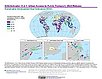
SDG Indicator 11.2.1: Urban Access to Public Transport, 2023 Release (
|
|
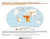
SDG Indicator 9.1.1: The Rural Access Index (RAI), 2023 Release (
|
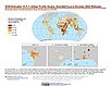
SDG Indicator 11.7.1: Urban Public Space, Availability and Access, 2023 Release (
|
|
Yale Center for Earth Observation (YCEO) Surface Urban Heat Islands, v4 (
|
Global Database of Light-based Geospatial Income Inequality (LGII) Measures, v1 (
|
|
Sub-global Scenarios that Extend the Global SSP Narratives: Literature Database, v1 (
|
Natural Resource Protection and Child Health Indicators, 2023 Release (
|
|
U.S. Social Vulnerability Index Grids, v1.01 (2000, 2010, 2014, 2016, 2018, 2020)U.S. Census Grids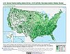
To provide a 1 km grid of the CDC Social Vulnerability Index (SVI) aligned with CIESIN's Gridded Population of the World, Version 4, Revision 11 (GPWv4.11) with a mask for water and no population. |
Global (GL) Annual PM2.5 Grids from MODIS, MISR and SeaWiFS Aerosol Optical Depth (AOD), v4.03 (
|
|
Water Security (WSIM-GLDAS) Monthly Grids, v1 (
|
Population, Landscape, And Climate Estimates (PLACE), v4 (2000, 2005, 2010, 2015, 2020)National Aggregates of Geospatial Data Collection (NAGDC)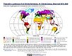
To provide tabular data to researchers without GIS capabilities who need data on population and land area by country across a range of physical characteristics. These include measures such as the number of persons living within coastal zones, the total area within a specific elevation strata, or the number of persons living within different climate zones. |
|
1 of 15
Prev
|
Next
|